
Simon stalls 435 km from Cabo San Lucas and is expected to start moving northwest tonight
The tropical storm has weakened slightly; no watches or warnings are in effect for Baja California Sur, but rain and high surf are still forecast through Saturday.
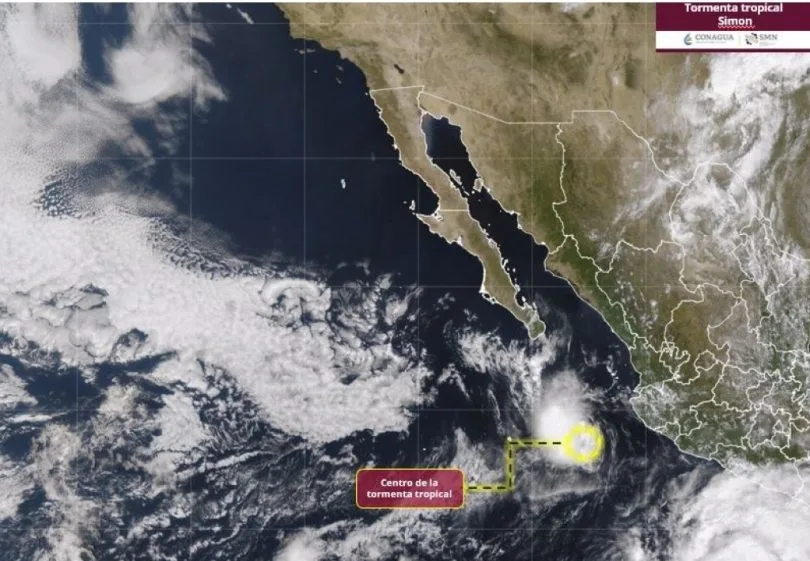
Tropical Storm Simon remains stationary 435 kilometers south-southeast of Cabo San Lucas, with maximum sustained winds of 95 km/h and gusts to 110 km/h, Baja California Sur's State Civil Protection Council said in its 11:00 a.m. advisory on Thursday, October 15. According to the Council, the system will begin moving northwest overnight.
A northwest track would carry Simon roughly parallel to the state's Pacific coast rather than straight toward southern Baja California Sur. That is why the main concerns remain rain and surf rather than wind.
What the afternoon advisory says
The U.S. National Hurricane Center, in its Advisory 34 at 2:00 p.m. local time, placed Simon at 19.3°N, 108.2°W, the same distance from Cabo San Lucas. It reported winds near 50 mph (about 85 km/h) and almost no motion, northwest at 1 mph (2 km/h), with faster movement starting Friday.
The agency expects Simon to weaken gradually and become a post-tropical remnant low over the weekend. As of that advisory, no tropical storm watches or warnings were in effect for Baja California Sur, though the agency said interests in the state should keep monitoring the storm.
Rain and surf: still in play
The National Hurricane Center's forecast matches the one shared by state Civil Protection: 25 to 50 millimeters (1 to 2 inches) of rain through early Saturday, with isolated totals up to 75 millimeters (3 inches). Swells from Simon could also cause life-threatening surf and rip currents along the coast.
The closure of the La Paz and Los Cabos ports to small vessels was announced Wednesday. Thursday's advisory says nothing about reopening, so fishermen and boat operators should check with the Port Captaincy before heading out.
Tonight's session
The State Civil Protection Council had called an extraordinary session for 8:00 p.m. Thursday. No decisions had been published at the time of writing, so any change to preventive measures will be announced through official state government channels.
Trudy, now a hurricane, is not aimed at BCS
In the same basin, Trudy has strengthened into a hurricane with winds near 90 mph (145 km/h), about 250 miles (400 km) southwest of Acapulco, according to the National Hurricane Center's Advisory 10. It is forecast to approach the coasts of Guerrero, Michoacán, Colima and Jalisco on Saturday; that advisory does not mention impacts for Baja California Sur.
What to do
A weak, stalled storm does not mean the risk is over: a slow cyclone can keep dropping rain over the same area for longer. In La Paz, Los Cabos and Comondú, do not cross flowing arroyos or low-water crossings, and stay out of the water at Pacific-facing beaches.
Keep a flashlight, water and documents in a waterproof bag. For emergencies, dial 911.
Related
Public Services crews are clearing the San José Viejo ford and the City Club area; municipal Civil Protection is monitoring possible rain on Monday, Oct. 19, and Tuesday, Oct. 20.
The State Civil Protection Council expects the tropical storm to weaken to a depression Friday afternoon; Hurricane Trudy is not expected to affect Baja California Sur.
State Civil Protection expects the system to decay into a tropical depression and remnant low between Friday and Sunday; only the port of La Paz remains open.
The cyclone is drifting slowly southwest, but small-craft port closures in La Paz and Los Cabos and the rain and surf watch remain in place.