
Simon weakens 400 km from Cabo San Lucas; isolated rain expected in southern Baja California Sur, waves up to 2 meters
State Civil Protection expects the system to decay into a tropical depression and remnant low between Friday and Sunday; only the port of La Paz remains open.
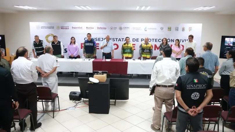
Tropical Storm Simon weakened to sustained winds of 75 km/h with gusts of 95 km/h and was located 400 kilometers south-southeast of Cabo San Lucas, the Baja California Sur State Civil Protection Council reported at its extraordinary session on Thursday night, October 15. Although the system is winding down, it may still bring isolated rain, mainly to the southern part of the state, this weekend.
What to expect Friday through Sunday
According to the forecast presented to the Council, between Friday, October 16, and Sunday, October 18, Simon will weaken from a tropical storm to a tropical depression and then to a remnant low. Any rain would be localized and concentrated in the south of the state, chiefly Los Cabos and La Paz.
Waves of up to 2 meters are expected on Friday and Saturday. Authorities urged extra caution along the coast and asked people to avoid risky activities on beaches and in small boats.
Ports: only La Paz is operating
The Council said the port of La Paz remains open, while the state's other ports stay closed until further notice due to the effects of a cold front. Navigation for small vessels had already been restricted at the ports of La Paz and Los Cabos since Wednesday, October 14.
How Simon evolved
Simon peaked as a Category 2 hurricane. On Wednesday, as a Category 1, Civil Protection projected 25 to 50 millimeters of rain for central and southern BCS, with isolated totals of up to 75 millimeters. That night it was downgraded to a tropical storm 445 km from Cabo San Lucas, and at 11:00 a.m. Thursday it was nearly stationary 435 km away with 95 km/h winds.
Governor Víctor Manuel Castro Cosío, who chaired the session, asked residents to stay informed and follow official instructions.
Also watching Trudy
The Council scheduled another session for Friday, October 16, at 8:00 a.m. to keep tracking Simon and review conditions related to Hurricane Trudy. Mexico's National Meteorological Service reported Friday that Trudy had strengthened to Category 3 on the Saffir-Simpson scale in the Pacific Ocean.
What to do
- Do not cross flowing arroyos or dips on foot or by car; even isolated rain can send water rushing down from the mountains.
- At Los Cabos and Pacific-side beaches, obey warning flags and stay out of the water while high surf and rip currents persist.
- Boat owners should check with the Port Captain's office before heading out.
- Rely only on official state and municipal Civil Protection updates; in an emergency, call 911.
Related
Public Services crews are clearing the San José Viejo ford and the City Club area; municipal Civil Protection is monitoring possible rain on Monday, Oct. 19, and Tuesday, Oct. 20.
The State Civil Protection Council expects the tropical storm to weaken to a depression Friday afternoon; Hurricane Trudy is not expected to affect Baja California Sur.
The tropical storm has weakened slightly; no watches or warnings are in effect for Baja California Sur, but rain and high surf are still forecast through Saturday.
The cyclone is drifting slowly southwest, but small-craft port closures in La Paz and Los Cabos and the rain and surf watch remain in place.